


Union Voting House, Henry County, Alabama
About
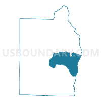
Outline

Summary
| Unique Area Identifier | 521922 |
| Name | Union Voting House |
| County | Henry County |
| State | Alabama |
| Area (square miles) | 54.37 |
| Land Area (square miles) | 54.25 |
| Water Area (square miles) | 0.12 |
| % of Land Area | 99.78 |
| % of Water Area | 0.22 |
| Latitude of the Internal Point | 31.49487520 |
| Longtitude of the Internal Point | -85.13144670 |
Maps


Graphs
Select a template below for downloading or customizing gragh for Union Voting House, Henry County, Alabama


Neighbors
Neighoring Voting District (by Name) Neighboring Voting District on the Map
- 099F - FREEMAN Voting District, Early County, GA
- 099U - URQUHART Voting District, Early County, GA
- Abbevile Armory, Henry County, AL
- Capps Post Office, Henry County, AL
- Haleburg Hall, Henry County, AL
- Newville Vt. House, Henry County, AL
- Shorterville House, Henry County, AL
- Tumbleton-Hebron-Browns, Henry County, AL
- Wills Cross Roads, Henry County, AL
Top 10 Neighboring County Subdivision (by Population) Neighboring County Subdivision on the Map
- Headland-Newville CCD, Henry County, AL (7,793)
- Blakely CCD, Early County, GA (7,728)
- Abbeville CCD, Henry County, AL (4,872)
- Shorterville CCD, Henry County, AL (3,093)
- Haleburg CCD, Henry County, AL (1,544)
Top 10 Neighboring Unified School District (by Population) Neighboring Unified School District on the Map
Top 10 Neighboring State Legislative District Lower Chamber (by Population) Neighboring State Legislative District Lower Chamber on the Map
Top 10 Neighboring State Legislative District Upper Chamber (by Population) Neighboring State Legislative District Upper Chamber on the Map
Top 10 Neighboring 111th Congressional District (by Population) Neighboring 111th Congressional District on the Map
Top 10 Neighboring Census Tract (by Population) Neighboring Census Tract on the Map
- Census Tract 303, Henry County, AL (3,093)
- Census Tract 302, Henry County, AL (2,962)
- Census Tract 902, Early County, GA (2,670)
- Census Tract 301, Henry County, AL (1,910)
- Census Tract 304, Henry County, AL (1,842)
- Census Tract 306, Henry County, AL (1,544)
Top 10 Neighboring 5-Digit ZIP Code Tabulation Area (by Population) Neighboring 5-Digit ZIP Code Tabulation Area on the Map
- 39823, GA (8,550)
- 36345, AL (7,822)
- 36310, AL (6,783)
- 36319, AL (2,276)
- 36353, AL (1,968)
- 36373, AL (581)